Geotechnical exploration
Securing reliable subsurface information is key in any geotechnical analysis. Both traditional and specialized investigation techniques have been conducted by our team throughout the various terrains of the country.
Completed Projects Nationwide
Years of Experience
Ready to solve your challenges?
With decades of experience, PGAI stands as a beacon of expertise and a trusted leader in the industry. We bring unparalleled expertise when it comes to Soil Exploration and Geophysical Testing to every project that we undertake, ensuring accurate and reliable results for our client.

Completed Projects Nationwide

Engaged in investigation and providing solutions to
problems involving soil properties, soil mechanics, water
quality, and failure analysis involving Civil Engineering
Structures.
Roster of experienced engineers and technicians together
with the skill and dedication of the drilling crew honed by
years of experience ensures quality in the testing,
evaluation, field instrumentation and testing of soils and
materials.
Specializes in extensive geophysical surveys field
reconnaissance work, detection of geotechnical
anomalies, and rapid ground characterization using non-
invasive techniques.
How can we help you?
There are so many reasons why PGATech should be your solutions provider in your search for geotechnical needs:
Expertise and Experience
We are a team of highly skilled and experienced Geotechnical Engineers who have a proven track record in delivering successful solutions. With decades of years of experience, our team is well-equipped to address complex geotechnical issues and provide effective solutions tailored to the unique requirements of each project.
Cutting-Edge Technology and Innovation
We pride ourselves on staying at the forefront of technological advancements in the field of geotechnical engineering. Our commitment to innovation allows us to deliver efficient, cost-effective, and sustainable geotechnical solutions that meet or exceed industry standards.
Comprehensive Range of Services
We offer a comprehensive suite of geotechnical services, providing end-to-end solutions for our clients. From initial site assessments and feasibility studies to detailed design, construction support, and ongoing monitoring, we are a one-stop solution for all geotechnical needs.
Client-Centric Approach and Collaboration
We prioritize our clients and their specific needs. By understanding the unique challenges of each project and tailoring our solutions accordingly, we ensure that our clients receive personalized, high-quality service that aligns with their objectives and exceeds expectations.
Featured Project
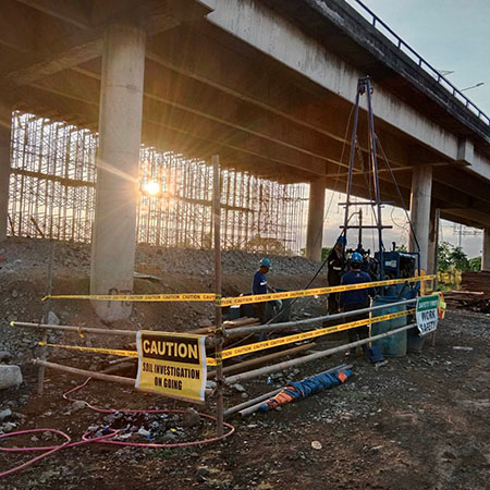
Central Luzon Project
A total of one hundred four (104) boreholes, (54) cone penetration tests, and (37) field vane shear tests were drilled at various depths in an existing expressway spanning 5 kilometers pushing through successfully against time and space constraints.
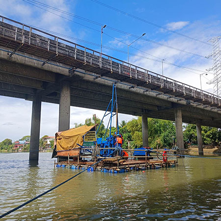
Services Offered: Onshore Drilling, Offshore Drilling, Cone Penetration Testing, Field Vane Shear Testing

Geotechnical Exploration Solutions
Geotechnical Investigation and Geophysical Exploration
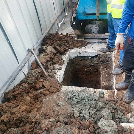
Soil Investigation
Subsurface exploration technologies including drilling and in-situ testing performed by skilled drilling crew honed by years of experience.
- Onshore Drilling
- Offshore Drilling
- Test Pitting
- Permeability Test (Falling Head Method)
- Standpipe Piezometer (Drilling and Installation)
- Field Vane Shear Test
- Electronic Cone Penetration Test
- Dynamic Cone Penetration Test
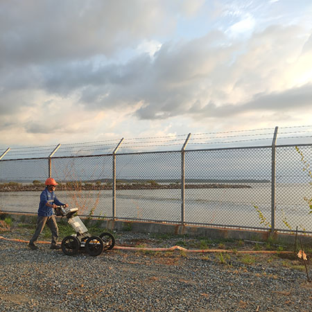
Geophysical Testing
Technologies for detailed soil stratification determination, subsurface characterization, and mapping of subsurface conditions using geophysical methods.
- Ground Penetrating Radar
- Downhole Seismic Testing
- Electrical Resistivity Testing
- Seismic Refraction Testing
- Electrical Resistivity Testing
Soil Mechanics Laboratory
Fully equipped soil mechanics laboratory certified under ISO Guide 25 and ISO/IEC 17025 assuring that the procedures and quality systems in testing are in conformity with world class standards.
- Soil Classification
- Particle Size Analysis
- Unit Weight and Density
- Atterberg Limits
- Shrinkage Limit
- Specific Gravity
- Moisture Content
- Swell Pressure
- Point Load Test
- Unconfined Compression Test
- Uniaxial Compressive Strength
- Laboratory Permeability Test
- Laboratory Miniature Vane Shear Test
- Consolidation Test
- Triaxial Test
- Direct Shear Test
- Chemical Tests (pH, Chloride, and Sulfate)
Geotechnical Consulting
Experienced and professionally trained principal and associates in the field of soils, structure, foundations, ground improvement, materials, and construction engineering.